About

About the Project

This project focuses on three problems which can be dealt with simultaneously: first, that of environmental degradation, second, that of peoples’ poor diet, and thirdly, that of diffused land use allocation to the various needs of the inhabitants of the target area. There is evident environmental degradation in various parts of Tanzania, and certainly in Kigoma, and some of the resulting effects are: i. Pollution of water sources due to various human activities such as farming close to water sources, ii. Soil erosion resulting partly from deforestation, bush fires and farming activities on hill slopes [devoid of terraces], iii. Drying of water springs and streams; iv. Poor soil fertility. In view of poor diet, most rural dwellers have some protein and starch sources for their meals [from beans, groundnuts and occasional fish and beef], but hardly any vitamin sources. Fruits and vegetables are eaten only casually, not as an essential part of a meal.
 
The project aims at bringing together the local population and concerned people, to arouse people’s interest towards improving the environmental status as well as their diet. This will involve the combined efforts of leaders, experts, local farmers and identified village communities within Kasumo Parish, Buhigwe District, Kigoma Region in Tanzania. This project also aims at dealing with improved nutrition by encouraging village communities to grow fruit trees and vegetables and making them part of their ever day meals. Prior to embarking on the two problems, implementation will involve going through the current land use allocation status and, through meetings and surveys involving as many villagers as possible or at least their representatives, establish in a more definitive way, with ultimate mapping and documentation, the actual land use priorities acceptable to the majority of inhabitants.
 
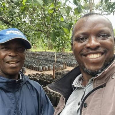
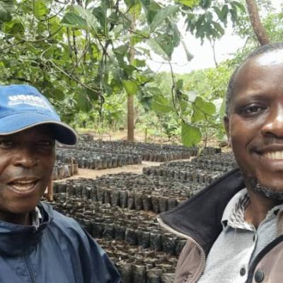
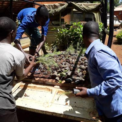
Land [19 acres] for the pioneer project has been acquired, on top of Gipfizi Hill, 4 km form Kasumo village. A tree [timber and fruit] nursery [at Kasumo] already has about 3,000 seedlings ready for planting this [2020-21] rain season. Aim for the future is to have as many seedlings as possible to cover all unused land [depending on village land distribution]; have seedlings available for interested villagers’ personal planting. The project experts will make use of meetings, seminars and video shows to create environmental awareness of the surrounding communities and educate people on ways of preservation of water sources as well as on the best  and safest methods of conducting human activities close to water sources, and the benefits of fruits and vegetables for human health.  The Pastor of Kasumo Parish, his Parish Council, the Kasumo Village Chairperson and the Village Council are involved, and all expressed their desire to ensure that the project is conducted to success. All will use their authority and influence to push the project going. The project will be owned totally by the Kasumo Parish Council, under the Diocese of Kigoma, and all the parish faithful will be involved in the various stages of implementation. Kasumo village will host the project, but the idea is to bring in all other villages benefitting from the rain catchment area of the hills seen on the Northern and Eastern part of Kasumo. The hills, known locally as Gipfizi, Vugilo, and Ndundugwa, are about 4 kilometres away. Gishigwe hill is much closer, on the Eastern side. The villages nearby are Kalege, Kajana, Mwanga and Buhoro. It is envisaged that all villagers within Kasumo Parish [about 85,000 people], irrespective of their religious beliefs, will be beneficiaries of the project, at various degrees [depending on interest and involvement]. This project is thought-out to be what might end up being an ongoing endeavour. There will be an evaluation at the end of every year, when the basic milestones will be examined. It will be a time to set new proposals and implementation methodologies. For now, the total cost of the project is estimated at about US $ 56,000 [= T. Shs.] for the 3 years. It is hoped that a number of activities will be accomplished through volunteerism.
Environmental degradation is a process by which the natural environment is compromised in some way, negatively affecting biological diversity and the general health of the environment. This process can be entirely natural in origin, or it can be accelerated or caused by human activities. Many international organizations recognize environmental degradation as one of the major threats facing the planet, since humans have only been given one Earth to work with, and if the environment becomes irreparably destroyed, it could mean the end of human existence.
 
The United Nations International Strategy for Disaster Reduction characterizes environmental degradation as the lessening of the limit of the earth to meet social and environmental destinations and needs. This can happen in a number of ways. At the point when the environment is destroyed, or common resources are exhausted, the environment is considered to be corrupted and harmed. There are a number of different techniques that are being used to prevent this. For this project we are opting for reforestation that will hopefully encourage restoration and flourishing of flora and fauna. Water sources will be preserved, and people will be encouraged to plant fruit trees and do bee keeping. They will be taught to garden vegetables for improvement of their diet.
 
Kasumo village is in Buhigwe district [as part of what was, for a long time, Kasulu District]. It is in Kigoma Region, Western Tanzania and borders Burundi on the West. Buhigwe district is one of the most populated areas in the region and probably has 319,243 people in the region [Kigoma] which has 2,706,831 people (estimate). Kasumo Village, established under the Villagization Program in 1973, has about 7,023 inhabitants in 824 families that live by subsistence farming with no major cash crop. Other nearby villages [with little variations in size and population as Kasumo] were established around that time [early 1970s], but residents have been [scattered] in the area for centuries. They are Kalege, Muyama, Biharu, Migongo, Kilelema, Kajana, Katundu, Mugera, Shunga, Buhoro and Mwanga.
 
Crops grown for food include maize [corn], beans, peas, groundnuts, cassava, sweet potatoes and bananas. Production of food is very poor and there are no statistics to show how much is produced, but it can be stated that families barely produce enough of what they need between one harvest season and the next. This leaves virtually no stock in store for sale or instances of droughts that can be catastrophic. Production of maize is often less than 7 bags [of 100 Kg] per acre. However, even when food quantities are not a problem, quality is always a problem.
 
It is true to say that 90% of the villages within Kasumo parish depend, for their water needs, on rivers and streams originating from Gipfizi-Ndundugwa-Gishigwe range of hills, making an important rain catchment area. These streams are: Misalala, Nyagonga, Muyovozi, Nyamibhaga, and even Ruchugi which is a major tributary to the Malagarasi, and ultimately to Lake Tanganyika. There are many other creeks and even fountains in the valleys that are fed from this catchment.
 
Protestant Missionaries [Anglicans] came to the area around 1920, and Catholics built their first post at Mulera, near Buhigwe, in 1926. Kasumo Parish was established in 1939 and from then on the White Fathers [now Missionaries of Africa] built a number of bush and primary schools [like iGisenga, iGasumo, iChome, iNyankende, iBhuhoro, iMwanga, iShunga, and a few other places] before the British colonial masters had any great influence, except tax collection. Arab and Greek traders had also visited the area, and places like iMbirira [near iKajana] gained some fame as these traders engaged in search for animal skins and other trophies. A few dispensaries were also put in place by the Christian Missionaries. Local / traditional administration of sub-chiefs stationed at Nyanga/Muyama and Buhoro, under the District Commissioner of the British administration at Kasulu, ultimately gave way to independent Tanganyika. All through, development as such has been a very slow process, with the natives generally left to make little strides to change on their own, through subsistent farming, little animal husbandry and no major cash crop. Until today, there are only two Secondary Schools in the area: Muyama – which is government owned, and Kasumo – which belongs to the Catholic Church!
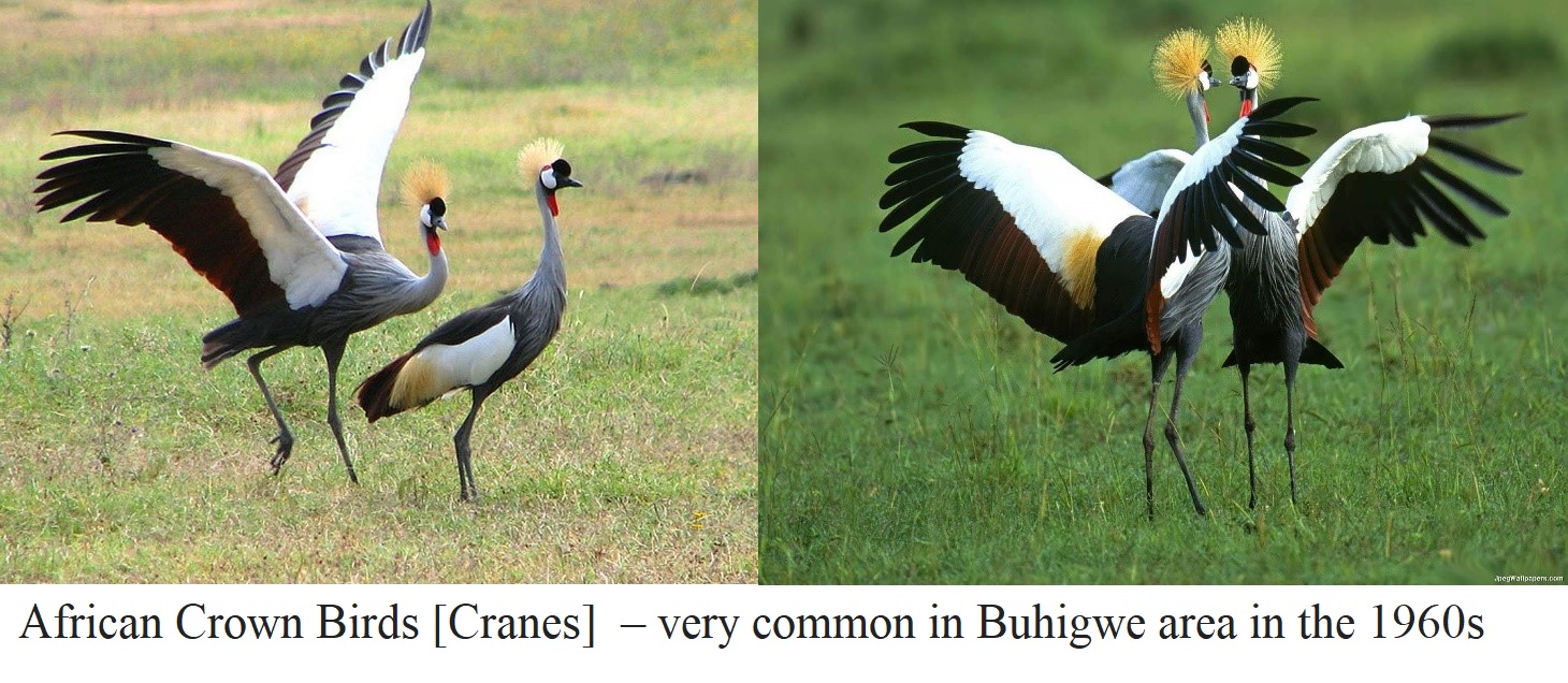
Our Mother Earth is currently facing lots of environmental concerns. Buhigwe District in Kigoma Region of Tanzania has not been spared of environmental degradation. The blessings of this land are still evidenced by what remains of hills and valleys covered with savannah grass and shrubs, rivers and streams flowing and submitting their tribute to Lake Tanganyika, swamps and marshlands where people get reeds and papyrus  grass for mat making and homestead shelters. Birds of all kinds [like the Guinea fowl and Crown birds / the African cranes and Ground hornbill] found their breeding ground. All these are disappearing or on the decline. Being densely populated in the 1930s through the 1960s because of high birth rate, and from immigrants from Burundi, Rwanda and elsewhere, the land became stressed with overgrazing and bush fires as evidenced from short grass over most of the area, and also desert-like patches of land covered by nothing [amakungu]. A good number of people voluntarily moved away to lower lands that were less populated [eastwards towards Nguruka, Urambo areas in Tabora region; Ushirombo and Kahama areas in the north] and even to less fertile lands, just to have space. The villagization program of Nyerere’s Ujamaa policy [early 1970s] saw more people moving away, but harm had been done already.
 
Besides overgrazing, Buhigwe land has also been burdened by tree cutting for firewood [the main wood consumer], charcoal making, house construction, and even lumbering for commercial purposes. Deforestation has, consequently, resulted in loss of topsoil, silting, and raising of riverbeds and consequent drying. Rain pattern has also been affected. Most noticeable in our Buhigwe area is the fact that animals for game are now found hundreds of miles away, trees for firewood or other uses are increasingly difficult to find, and water sources and streams are evidently drying up. Even places used as sources for gravity water supply to villages are not spared.
 
Standing on top of the hills overlooking Kasumo and Kajana villages one easily notices that the villages appears to be planted with trees, while the surrounding areas [outside the villages] are bare and eroded. Even outside the villages the trees planted are mostly Eucalyptus, which are said to be unsuitable for moisture preservation, leaving the land dry, especially when they are grown in [river] valleys. Misalala, the major stream close to the village [on the Northern and Western side], and Muyovozi [on the Southern side], both show obvious signs of diminishing volumes of water. Nyagonga, a smaller stream that joins Misalala, has now become a seasonal stream while it was, until recently, a perennial stream. Short distances away from villages, especially in river valleys, there were bushes where people could hunt guineafowl, rabbits and even antelopes and water hogs. In the early 1960s hyenas and leopards were still common. All these have disappeared from the area.  
 
An aerial view of our villages shows patches of land with farms, both in the valleys and on hill slopes. There are a few wooded areas and more of grassland where people graze their cattle, sheep and goats. Houses are built close by, but each household owns about an acre for housing. New buildings can be seen within the village slowly extending outside the main settlement area. You can also see one or more primary schools, religious buildings, village offices, shops, and the marketplace. The allocation of land use to all these uses has been done without expert direction. Boundaries between villages are not clear; authorities cannot tell what percentage of land is allocated to what use; no mapping nor documentation exists for the distribution, and clever individuals can grab more share than everyone else deserves. Proper land use planning and allocation is therefore required.
 
While environmental degradation can easily be noticed from a distance, one needs to sit and eat with families to notice other problems. One such problem is lack of fruits [as part of the meal]. Vegetables are availed and cooked for or as part of meals only occasionally. Kigoma region inhabitants generally consider fruits as an optional snack that one can take casually, when one finds them, and something to keep children from crying of hunger before meals of the day! Some education is necessary to convince people of the importance of fruits and vegetables for body health.
birds.jpg
General Objective
The main objective of this project is to conserve and protect all environmentally affected areas in and around Kasumo-Kalege-Kajana-Mwanga-Buhoro villages [Buhigwe district] for sustainable livelihoods, and to grow fruit trees and make fruits and vegetables part of  everyone’s daily meal. Parishioners agreed that they will plant at least 20,000 tree seedlings [fruit and timber] on 20 acres every year.
Specific Objectives
Specific objectives that this project is intended to achieve are:
  1. Have the target area reasonably portioned out and allocated to various human uses, after surveys involving inhabitants and village authorities [of all the 5 targeted villages].
  2. Have at least 120 acres of land covered with trees in three years [60 in Kasumo and 40 in each of the other 4 villages – Kalege, Kajana, Buhoro, Mwanga]
  • Villagers in the target area empowered with knowledge on use of terraces and the hazards of bush fires, reasonable harvest of trees, and how to do safe farming near water sources.
  1. Improved quality meals in the target area, with the aim of boosting health, through consumption of fruits and vegetables.
  2. Have in place a nursery where villagers in Kasumo-Kalege-Kajana-Buhoro-Mwanga can get seedlings for timber and fruit trees.

With the intention of establishing common ground among experts and laypersons, we begin by defining our terms simply and succinctly: 

Community here it refers to a “community of place” that includes those people whose livelihoods take place in the proximity of affected sites, specifically those in Kasumo Parish, for whom the hills of Gipfizi, Vugilo, Gishigwe and nearby hills make a rain catchment zone.   

Livelihoods are defined as the activities, assets, capabilities and strategies required and employed as a means of living (Schuyt 2005).  Livelihoods include the ways and means of satisfying peoples’ fundamental needs.  Livelihoods are ways of living, and not only ways of making a living. 

Environment refers to the physical reality in which a society and its members live and depend on for their livelihood and resources which they draw to sustain their being, and in reciprocity also contribute positively or negatively to it. The resources that we commonly refer to are water and water sources, air and the atmosphere, vegetation, soils, animals, and insects – all flora and fauna, seen with the naked eye or not. 

Sustainability, as far as human endeavor is concerned, refers to the force, power and endurance that a project has, not only to hang on through existence but especially to overcome obstacles that would otherwise render it ineffective and redundant, and so fail to produce desired and expected results. Ownership of project by beneficiaries has often times been identified to be key in project sustainability, since this enhances interest, responsibility and zeal.

Project Leaders

Image

Sebastian Mpango Nzabhayanga - Councillor

Image

Teonest C. Tereba - Chairperson

Image

Gaspar Kamarasente - Vice Chairperson

Image

Vitus Chaniko - Executive Secretary

Image

James Kayingiriza - Assistant Executive Secretary

Image

Dismas J. Masunzu - Treasurer

Contact

Kigoma Green Revolution Organization [KGRO]

KGRO Head Office

Junction Road from Kasulu Town Council Office to Serengeti Hotel

P.O. Box 297

District: Kasulu

Ward: Murusi

Region: Kigoma.

Company Status: Non-Governmental Organization

Email Address: info@kgro.or.tz

Registration No: ooNGO/R/3141